Key Takeaways
- All five road trips start within a day's drive of Red Deer, ranging from a single-day badlands run to Drumheller to a two- or three-day mountain loop on the Icefields Parkway.
- The David Thompson Highway (Highway 11) runs 255 km from Red Deer to Saskatchewan River Crossing, passing Sylvan Lake, Rocky Mountain House, Nordegg and Abraham Lake — Alberta's largest reservoir.
- Gravel is part of the appeal: the Smith-Dorrien/Spray Trail in Kananaskis is roughly 60 km of mostly unpaved road, and much of the Forestry Trunk Road (Highway 734) west of Sundre and Caroline is gravel.
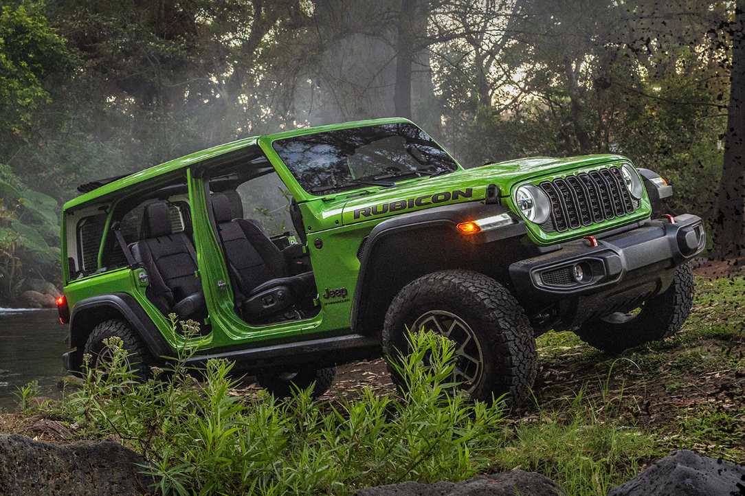
- Every 2026 Wrangler is Trail Rated and uses solid front and rear axles, steel skid plates and tow hooks. Command-Trac 4x4 has a 2.72:1 low range; the Rubicon's Rock-Trac system uses a 4:1 low range with Tru-Lok front and rear lockers.
- Services are thin in the mountains. The Icefields Parkway has one seasonal gas station in its 232 km and no cell coverage, and in winter there are no gas stations or services between Nordegg and Lake Louise.
- 2026 fees to budget: Parks Canada daily admission of $12.25 per adult or $24.50 per family/group, a $15 daily or $90 annual Kananaskis Conservation Pass, and a $20 three-day or $30 annual Public Lands Camping Pass per person for random camping.
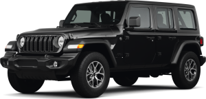
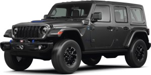
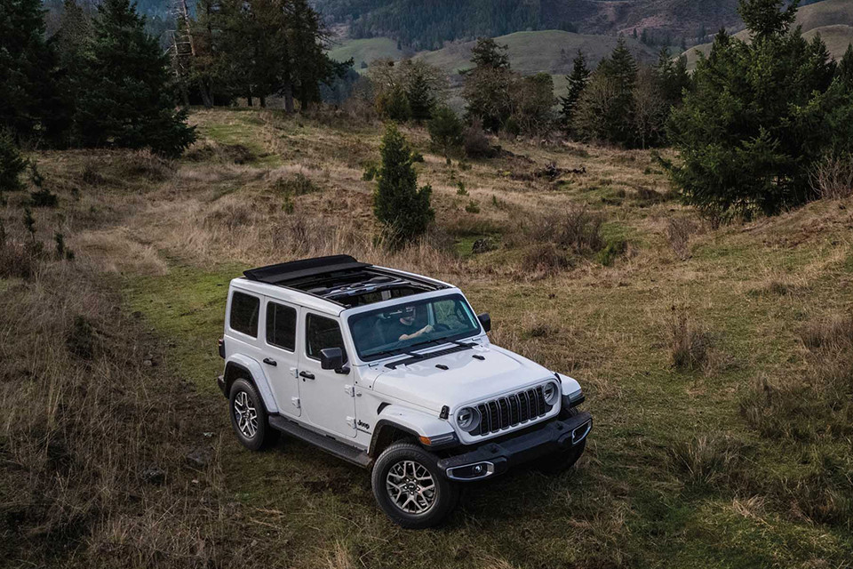
Central Alberta sits in a sweet spot for road trips. Point a 2026 Jeep Wrangler west from Red Deer and the Rockies are a few hours away; point it southeast and you're in the badlands before lunch. Few vehicles suit that range better. The Wrangler takes the washboard gravel of a forestry road as calmly as a long stretch of Highway 2, and in summer you can take the roof off and drop the doors for mountain air the whole way.
This guide ranks the five best road trips from Red Deer for a Wrangler owner, with verified 2026 distances, the passes you'll need, road surfaces, and which 4x4 settings help on each route. Whether you drive a Sport, a Sahara or a Rubicon — and if you're still deciding, our Rubicon vs Sahara trim comparison can help — each of these trips is within reach of a stock Wrangler and a full tank of fuel.
Why Is the Jeep Wrangler a Good Road Trip Vehicle from Red Deer?
Road trips from Red Deer rarely stay on pavement. The best viewpoints, campgrounds and trailheads west of Highway 22 sit at the end of gravel roads, and Alberta's shoulder seasons can bring snow to the mountain passes in September and May. A road trip vehicle here has to handle loose surfaces, sudden weather and long distances between services.
The Wrangler is built for exactly that. Every 2026 Wrangler earns Jeep's Trail Rated badge and comes with solid front and rear axles, steel skid plates and tow hooks. The gas-powered 4-door carries an 81 L (21.5 US gal) fuel tank, and you can choose the 3.6L Pentastar V6 (285 hp, 353 Nm) or the 2.0L turbocharged four-cylinder (270 hp, 400 Nm). Our 2026 Jeep Wrangler overview covers the full lineup. On a road trip, what matters is that the drivetrain you pick at the dealership is the same one that gets you to Abraham Lake in January or up the Smith-Dorrien Trail in July.
Command-Trac vs Rock-Trac: What Matters on Gravel and Mountain Roads
The Wrangler's standard Command-Trac part-time 4x4 system has a 2.72:1 low-range ratio. It's the right tool for the gravel, packed snow and steep campground roads on all five of these routes. Leave it in two-wheel drive on dry pavement, then shift into 4H when the surface turns loose or icy.
The Rubicon moves up to the Rock-Trac transfer case with a 4:1 low range, plus Tru-Lok electronic locking differentials front and rear and an electronic front sway-bar disconnect for more wheel travel. None of these road trips requires a Rubicon. It's worth it if you plan to leave the maintained road for rougher side routes, provided those routes are legally open to highway vehicles.
Top 5 Road Trips from Red Deer at a Glance
The table below compares the five road trips side by side. Distances are approximate driving figures from Red Deer, and seasons reflect when roads, ferries and services are reliably open. Always check 511 Alberta for current road conditions before you leave.
| Road Trip | Distance from Red Deer | Road Surface | Passes Needed | Best Season | Trip Length |
|---|---|---|---|---|---|
| 1. David Thompson Highway to Nordegg & Abraham Lake | ~170 km to Nordegg; 255 km to Saskatchewan River Crossing | Paved highway; gravel side roads | Public Lands Camping Pass for random camping | Year-round (ice bubbles mid-January to mid-February) | Day trip or weekend |
| 2. Icefields Parkway Loop | ~640 km loop via Highway 11, Lake Louise and Calgary | Paved | Parks Canada admission | June to September | 2–3 days |
| 3. Drumheller & the Dinosaur Trail | ~160 km | Mostly paved; seasonal cable ferry | None for the drive | Spring to October (Bleriot Ferry season) | Day trip |
| 4. Kananaskis & the Smith-Dorrien Trail | ~230–250 km to Canmore | ~60 km of gravel on Highway 742 | Kananaskis Conservation Pass | Summer and fall (Highwood Pass section closed Dec 1–Jun 14) | Day trip or weekend |
| 5. Cowboy Trail & Forestry Trunk Road Loop | Full-day loop via Innisfail, Caroline, Sundre and Olds | Paved highways plus long gravel stretches on Highway 734 | Public Lands Camping Pass for random camping | Late spring to fall | Day trip or weekend |
If you only have a Saturday, Drumheller and the Nordegg run are the easiest to fit in a day. For a long weekend, the Kananaskis and Forestry Trunk Road trips add gravel and backcountry camping. The Icefields Parkway loop deserves at least two nights — the scenery between Saskatchewan River Crossing and Lake Louise is worth taking slowly.
Distance between fuel stops matters more than anything else on these routes. With an 81 L tank, a 4-door Wrangler covers these trips comfortably, but mountain grades, headwinds, roof-off driving and gravel all push fuel use up. Top up in Rocky Mountain House or Nordegg before heading west on Highway 11, and in Sundre or Caroline before any extended gravel on the Forestry Trunk Road.
Which Wrangler 4x4 Setting to Use on Each Route
| Setting | What It Does | Where It Helps on These Trips |
|---|---|---|
| 2H (rear-wheel drive) | Default mode for dry pavement; best fuel economy | Highway 2, Highway 11 and the Icefields Parkway in summer |
| 4H Part-Time | Locks front and rear driveshafts together for traction on loose or slippery surfaces; not for dry pavement | Smith-Dorrien gravel, Forestry Trunk Road washboard, snow-packed Highway 11 near Abraham Lake |
| 4L (2.72:1 Command-Trac / 4:1 Rock-Trac) | Multiplies torque for slow, controlled climbs and descents | Steep, rutted campground or random-camping access roads |
| Tru-Lok Lockers (Rubicon) | Forces both wheels on an axle to turn together | Deep ruts or a wheel lifted off the ground on a rough side road |
| Front Sway-Bar Disconnect (Rubicon) | Frees the front suspension for more articulation at low speed | Uneven, low-speed terrain only — reconnect before returning to pavement |
Road Trips #1 and #2: The David Thompson Highway and the Icefields Parkway
The two mountain trips share a starting point: Highway 11, the David Thompson Highway, which leaves Red Deer heading west past Sylvan Lake and Rocky Mountain House and ends 255 km later at Saskatchewan River Crossing on the Icefields Parkway. Drive part of it for a day trip, or all of it as the first leg of a bigger mountain loop.
Road Trip #1: David Thompson Highway to Nordegg and Abraham Lake
| Stop | Approx. Distance from Red Deer | What to Know |
|---|---|---|
| Sylvan Lake | ~18 km | First stop off Highway 11 for coffee and a lakefront stretch. |
| Rocky Mountain House | ~81 km | Last large town on the route — top up fuel and supplies here. |
| Nordegg | ~170 km | Historic mining community and gateway to Abraham Lake and the Forestry Trunk Road. |
| Abraham Lake | West of Nordegg along Highway 11 | Alberta's largest reservoir: 32 km long and 53.7 km², created by the Bighorn Dam in 1972. |
| Saskatchewan River Crossing | 255 km | Western end of Highway 11 at the Icefields Parkway; a Parks Canada pass is required past this point. |
If you're coming from the west side of Central Alberta, Highway 11 runs right past our neighbours in Sylvan Lake and Rocky Mountain House. Abraham Lake's turquoise water draws summer photographers, but winter is its signature season. Methane released by decaying plants on the lake bed gets trapped in the ice as frozen bubbles, and the best viewing runs from mid-January to mid-February after the lake freezes in late December. The lake is named for Silas Abraham, a Stoney Nakoda farmer and hunter who lived on the Kootenay Plains.
Winter planning matters here. There are no gas stations or services between Nordegg and Lake Louise in winter, so leave Nordegg with a full tank. In a Wrangler, 4H Part-Time is useful on the snow-packed highway shoulders and lakeside pull-outs. If you plan to random camp on public land along the Eastern Slopes, anyone 18 or older needs a Public Lands Camping Pass.
Road Trip #2: Icefields Parkway Loop via Saskatchewan River Crossing
| Leg | Approx. Distance | Highlights |
|---|---|---|
| Red Deer to Saskatchewan River Crossing (Highway 11) | 255 km | Sylvan Lake, Rocky Mountain House, Nordegg, Abraham Lake |
| Optional side trip north to the Columbia Icefield | ~50 km each way | Largest icefield south of the Arctic Circle, covering 325 km² |
| Saskatchewan River Crossing to Lake Louise (Highway 93) | ~78 km | Peyto Lake and Bow Summit, Bow Lake |
| Lake Louise to Red Deer (Highway 1 and Highway 2 via Calgary) | ~300 km | Easy four-lane return; fuel and food in Banff, Canmore and Calgary |
The Icefields Parkway runs 232 km between Lake Louise and Jasper, and a Parks Canada pass is required to travel it. The speed limit is 90 km/h, there is no cell coverage, and the parkway's only gas station, at Saskatchewan River Crossing, operates June through September. Download offline maps before leaving Rocky Mountain House, and fill the tank in Nordegg. This loop suits a Wrangler with the roof off in July and August. In the shoulder seasons, plan for sudden snow — winter tires or chains are legally required on the parkway through the winter months, and the road can close without warning.
Road Trip #3: Drumheller and the Canadian Badlands
For a day trip in the other direction, drive roughly 160 km southeast to Drumheller, about two hours from Red Deer. The same Red Deer River that runs through our city flows through Drumheller, lined by the badlands you'll drive through. This is the most relaxed trip on the list: the roads are mostly paved, the distances are short, and it's ideal for a first open-air Wrangler outing with the family.
| Stop | Location | What to Know in 2026 |
|---|---|---|
| Royal Tyrrell Museum of Palaeontology | Highway 838, Midland Provincial Park, 6 km northwest of Drumheller | September 1 to May 14: open Tuesday to Sunday, 10 a.m. to 5 p.m. (no entry after 4 p.m.); closed Mondays except holiday Mondays |
| Dinosaur Trail | 47.3 km loop on Highways 838, 837 and 575 | Follows the Red Deer River through Starland and Kneehill counties, past Horsethief Canyon |
| Bleriot Ferry | Highway 838 over the Red Deer River | Free cable ferry running since 1913; 8 a.m. to 11 p.m. from mid-spring to the September long weekend, then 8 a.m. to 7 p.m. until October 30; carries up to 13 mid-size vehicles |
| Horsethief Canyon | Along the Dinosaur Trail | Viewpoint over the badlands coulees — a good first photo stop |
The Bleriot Ferry is the reason to do this trip before the end of October. When it shuts for winter, the full Dinosaur Trail loop isn't possible, and you'll need to backtrack through Drumheller to finish the drive.
The badlands are no place for off-road improvising. The coulees are fragile, and parts of the land along the trail are protected parkland or private property, so stick to posted roads and parking areas. Save the Wrangler's trail hardware for the mountain routes and enjoy this one with the top down.
Road Trip #4: Kananaskis Country and the Smith-Dorrien Trail
Kananaskis Country is the classic Wrangler gravel drive for Central Albertans. From Red Deer, it's roughly 230–250 km, or about two and a half to three hours, to Canmore. From there, the Smith-Dorrien/Spray Trail (Highway 742) climbs past the Spray Lakes Reservoir and connects to Peter Lougheed Provincial Park over roughly 60 km of mostly gravel road.
| Detail | Smith-Dorrien/Spray Trail (Highway 742) | Highway 40 / Highwood Pass |
|---|---|---|
| Surface | Mostly gravel, with dust, washboard and occasional rough sections | Paved |
| Length / Elevation | ~60 km, Canmore to Peter Lougheed Provincial Park | Highwood Pass at 2,206 m — the highest paved pass in Canada |
| Seasonal Access | Open year-round; conditions change quickly with weather | Closed to vehicles each year from December 1 to June 14 |
| Wildlife | Moose, black bears, coyotes, bighorn sheep and mountain goats are common | Frequent wildlife on the road — watch speed |
| Pass Required | Kananaskis Conservation Pass (when stopping in the area) | Kananaskis Conservation Pass (when stopping in the area) |
| Best Wrangler Setting | 2H in dry conditions; 4H Part-Time on loose, wet or snowy gravel | 2H |
The Kananaskis Conservation Pass costs $15 per day for one personal vehicle or $90 per year for up to three vehicles. It isn't required on Wilderness Wednesdays (the first Wednesday of each month) or on nine designated holidays. Summer weekends can bring heavy traffic and thick dust on the Smith-Dorrien, so leave extra following distance and drive the gravel slowly — washboard at speed is hard on tires and suspension. For a full loop, drive the Smith-Dorrien from Canmore to Kananaskis Lakes, then take Highway 40 north back to Highway 1. Between June 15 and November 30, you can also extend the drive south over Highwood Pass.
Road Trip #5: Cowboy Trail and Forestry Trunk Road Gravel Loop
This loop stays closest to home and makes the most of a Wrangler's 4x4 system. It links Highway 22 (officially the Cowboy Trail) with the Forestry Trunk Road (Highway 734), a long foothills route that crosses the Red Deer, James, Clearwater and Ram rivers on its way to Nordegg.
| Leg | Route | What to Expect |
|---|---|---|
| Red Deer to Caroline | Highway 2 south to Innisfail, then Highway 54 west through Spruce View | Highway 54 runs 69.4 km from Highway 2 to Highway 22, crossing the Red Deer, Medicine and Clearwater rivers |
| Caroline to the Forestry Trunk Road | Highway 591 west toward Ricinus | Farmland gives way to foothills forest |
| Forestry Trunk Road (Highway 734) | South from Highway 591 to Highway 584 (about 21 km) | Gravel foothills driving with public campgrounds along the corridor |
| Optional: Ram Falls Provincial Park | North on Highway 734; the park is 64 km south of Nordegg | A roughly 20 m waterfall; 54 unserviced campsites open June to September; no drinking water or cell service |
| Sundre to Olds | Highway 584 east to Sundre, then Highway 27 east 39.5 km to Olds | Back on pavement, with fuel and food in both towns |
| Olds to Red Deer | Highway 2 north | Easy four-lane run home |
The loop passes through two communities we serve every day: Innisfail at the start and Olds near the end. The Forestry Trunk Road is where a Wrangler earns its keep. The gravel is usually well graded, but dust, potholes, oncoming traffic and loose corners after rain call for 4H Part-Time and a relaxed pace.
Random camping along this stretch of the Eastern Slopes requires a Public Lands Camping Pass for anyone 18 or older. Stay on designated roads and trails, and never drive through streams or wetlands: it damages fish habitat and is often prohibited on public land. Carry a full-size spare, recovery gear and a paper map, because cell coverage disappears quickly west of Highway 22.
Passes, Permits and Fees for Alberta Road Trips in 2026
A few passes are all it takes to legally enjoy these five road trips. The fees below were confirmed with the Government of Alberta and Parks Canada in September 2026. Prices can change, so check the official sites before you go.
Alberta Provincial Passes
| Pass | Price (CAD) | What It Covers | Used On |
|---|---|---|---|
| Kananaskis Conservation Pass — Day | $15 | One personal vehicle | Road Trip #4 |
| Kananaskis Conservation Pass — Annual | $90 | Up to three personal vehicles for 365 days from purchase | Road Trip #4 |
| Public Lands Camping Pass — 3-Day | $20 per person | Random camping on public land along the Eastern Slopes (ages 18+) | Road Trips #1 and #5 |
| Public Lands Camping Pass — Annual | $30 per person | Same coverage for a full year; a $3.25 processing fee plus GST per transaction and a one-time $8 Wildlife Identification Number also apply | Road Trips #1 and #5 |
Parks Canada Admission (Banff and Jasper)
| Pass Type | Price (CAD) | Notes |
|---|---|---|
| Daily — Adult (18–64) | $12.25 | Required on the Icefields Parkway (Road Trip #2) |
| Daily — Senior (65+) | $10.75 | Per person, per day |
| Daily — Family/Group | $24.50 | Up to seven people in one vehicle |
| Youth (17 and under) | Free | Park entry only; camping and other services are extra |
| Parks Canada Discovery Pass — Family/Group | $167.50 | Annual pass for all national parks; adult $83.50, senior $71.50 |
Passes are only part of trip prep. A pre-trip inspection — tires, brakes, fluids, wipers and battery — is worth booking before any long mountain or gravel drive. For current 2026 Wrangler pricing and in-stock inventory, call Red Deer Dodge at 403-346-2035.
Which Red Deer Road Trip Is Right for Your Wrangler?
The right trip depends on how much time you have, the time of year and how much gravel you want. Here's how the five compare for different kinds of Wrangler owners in Central Alberta.
For a first Wrangler road trip or a family day out, start with Drumheller. The distances are short, the roads are mostly paved, and the Bleriot Ferry crossing and Royal Tyrrell Museum keep kids engaged. The David Thompson Highway to Nordegg and Abraham Lake is the next step up: more remote, more scenic, and a winter trip unlike anything else in Alberta.
For Wrangler owners who want gravel and mountains, Kananaskis and the Forestry Trunk Road loop deliver the most time on unpaved roads, and both reward a Rubicon's extra hardware if you venture onto rougher side roads that are legally open. The Icefields Parkway loop is the showpiece — plan it for summer, bring a Parks Canada pass, and budget two or three days so you're not rushing the stops.
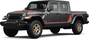
If your road trips involve more gear than a Wrangler's cargo area can handle — a canoe, firewood, coolers for a week of camping — the Jeep Gladiator pairs Wrangler-style Trail Rated capability with an open pickup box. Our team at Red Deer Dodge can help you compare both for the trips you have in mind.